


EGYPT: PGS Release West MC3D Depth Merge and Interpretation
- Post-stack depth-merge
- over 24 000 sq. km of data
- raw and final KPSDM full-stack volumes in time and depth
- migration velocity model in depth
- processing report
These data have now been merged into a single full stack depth seismic volume (KPSDM), including two pre-existing reprocessed overlapping MC3D surveys (legacy 3D data).


The wider area was mapped using 2D seismic data in 2016 and 2018, providing an extensive overview of the regional geology and structure. The new West Egypt 3D Merge allows explorers to gain a far more detailed overview of the plays and structures available. This includes the shelf area, which is an extension of the proven onshore western desert play fairways and is likely to rank highly as a focus area for upcoming exploration activity.
Farther into the basin, there is the potential for shelf-edge structures and carbonate buildups, some of which are sealed by Messinian evaporites. In the deeper water areas, plays relating to pre-Messinian salt structures and pinch-out features against the shelf edge are also likely to be a focus for explorers.
This is an ideal screening product for companies to quickly evaluate the subsurface potential of this frontier area
“This merged MC3D volume is an ideal screening product for companies looking to rapidly evaluate the subsurface potential of this frontier area, prior to committing to pre-stack seismic products or entering the area. The PSDM volume is now available for licensing,” says Mark Hamilton, PGS principal geoscientist for Africa, Mediterranean and Middle East.
Updated West Egypt Interpretation
Consulting company Petroguide has produced an updated interpretation of our Egypt West Mediterranean Offshore Interpretation Study. The original was carried out by PGS, in collaboration with EGAS, and was based on 2D data acquired in 2016 and reprocessed legacy 2D data. The updated 2022 interpretation product includes the additional 2D data acquired in 2018 and the two reprocessed legacy MC3D datasets, as well as a study linking the onshore western desert to the offshore. It also includes additional well analysis, geoseismic sections, and updated leads.
This report is now available for licensing along with a prerequisite minimum seismic data purchase.


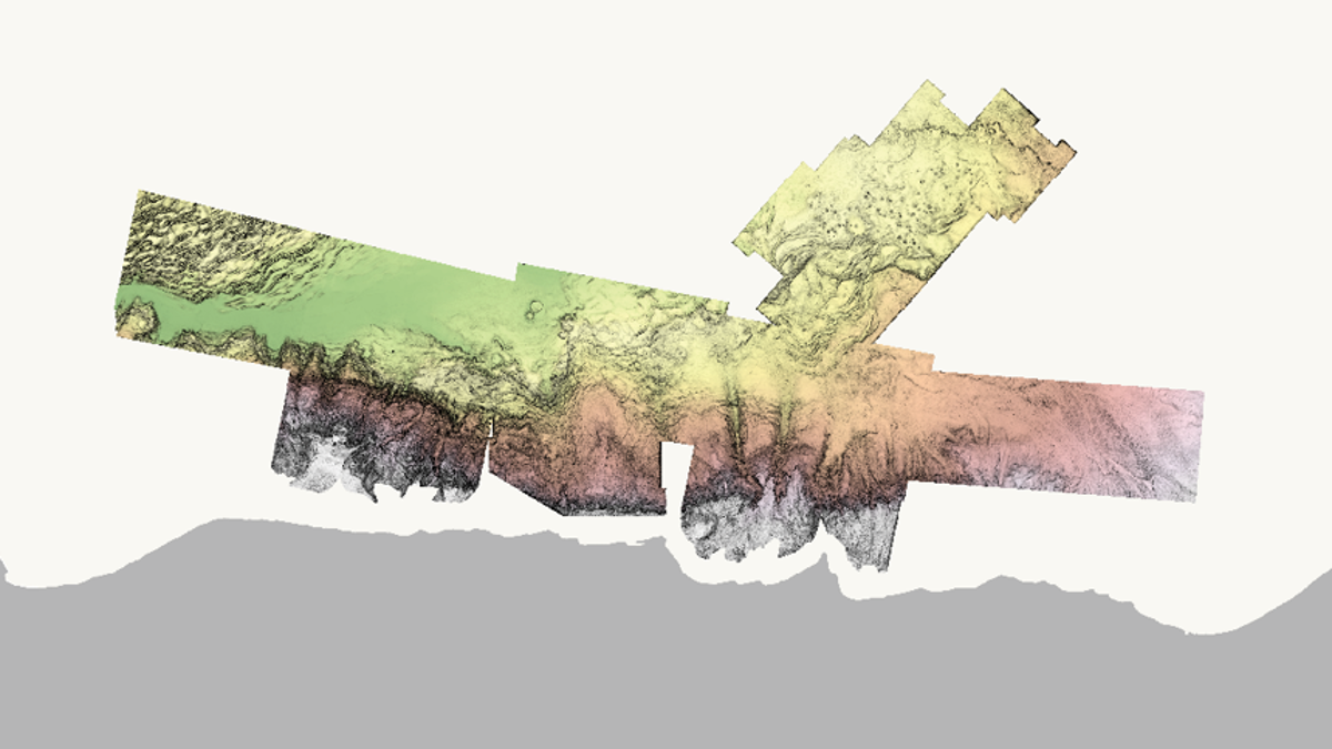
Seismic depth section from the Egypt MC3D showing some of the structures on the shelfal area. Note that this section shows imaging to beyond 6 km depth.