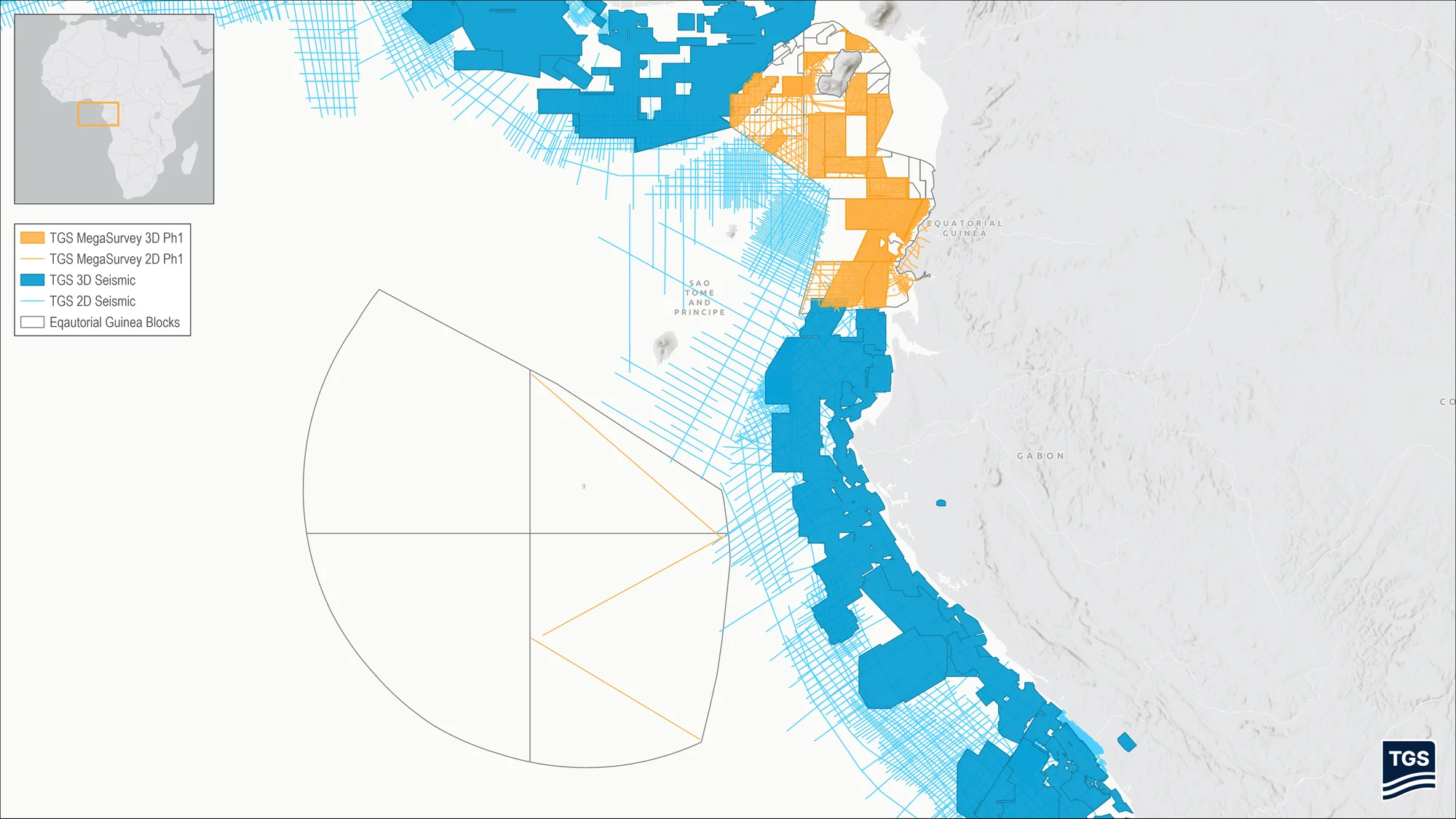


EQUATORIAL GUINEA: TGS Begins First Phase of Major Offshore Seismic Dataset off the Gulf of Guinea
TGS announced the signing of an agreement with the Ministry of Hydrocarbon and Mining Development of the Republic of Equatorial Guinea to create an offshore MegaSurvey, a large-scale multi-client seismic product.
The first phase will include the post-stack reprocessing of approximately 27,273 kilometers of 2D seismic data and around 35,000 square kilometers of 3D seismic data, with completion expected in Q3 2026.
MegaSurveys are harmonized 3D seismic datasets covering large contiguous areas. They support more confident geological interpretation, improve understanding of structural and stratigraphic frameworks, and help reduce exploration uncertainty.
The agreement marks the first phase of a broader plan to create a harmonized and seamless seismic data product across Equatorial Guinea’s offshore basins. The full product vision includes approximately 46,343 line kilometers of 2D seismic data and more than 59,000 square kilometers of 3D seismic data.
David Hajovsky, Executive Vice President, Multi-Client at TGS, commented: “The Equatorial Guinea MegaSurvey is the first of its kind in the country and will apply TGS’s latest imaging technology to address key subsurface challenges and support exploration risk reduction across the Rio del Rey and Rio Muni basins. The product is designed to provide customers with a basin-wide regional screening tool, supporting prospect identification, prospect ranking and planning for future work commitments.”
By integrating and reprocessing legacy datasets into a consistent regional framework, the MegaSurvey will provide new insight into the prospectivity of Equatorial Guinea’s offshore basins and support informed exploration decision-making.
Basins do not stop at geographical borders, and this agreement supports TGS’s longer-term ambition to build broader, seamless regional data products across the Gulf of Guinea.