

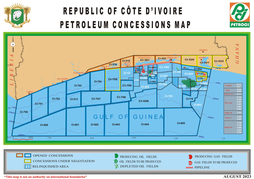


Airborne Gravity Gradiometry Survey over Lake Tanganyika North Block Commences
The Tanzania Petroleum Development Corporation (TPDC) has said it has started acquiring a non-invasive Airborne Gravity Gradiometry Survey over wholly operated Lake Tanganyika North Block which cuts across five districts namely; Kigoma rural, Kigoma, Ujiji, Uvinza and Mpanda rural.
The survey which started November 17th expected to take three months is to acquire high resolution gravity and magnetic data to map subsurface structural geological framework, thickness and extent of the sedimentary rocks over Lake Tanganyika rift basin.
According to TPDC the Airborne Gravity Gradiometry Survey data is expected will assist in planning 2D seismic survey in order to identify potential areas associated with hydrocarbon deposition and subsequently identifying drilling targets.
The survey campaign will be conducted using a low-flying special aircraft which will be flying between the altitude 80m and 100m above the ground at a speed of 220kms/hour. The survey will be flown during the day light time non-invasive (noninvasive technique).
The project is funded 100% by TPDC from its own Development Fund.